AI-Assisted Monitoring Tracks Chinook Migration into the Upper Klamath Basin
Sonar, AI, and tagging data reveal Chinook return one year after dam removal
KLAMATH BASIN — One year after the removal of dams along the Klamath River, newly released monitoring data shows thousands of Chinook salmon migrating deep into reopened habitat, with some fish traveling more than 360 river miles from the Pacific Ocean into the Upper Klamath Basin for the first time in over 100 years.
The findings come from one of the most comprehensive fish monitoring efforts in the western United States, led by CalTrout in partnership with more than 19 Tribal, state, federal, academic, and nonprofit organizations. Researchers say the early results provide strong evidence that salmon are rapidly recolonizing historic spawning grounds following dam removal.
“This data is crucial to help us understand how successful dam removal has been and to guide the trajectory of recovery,” said Damon Goodman, CalTrout’s regional director. “We’re not missing a beat.”
Early Results Show Strong Chinook Return
Preliminary monitoring data from the 2025 fall run indicates a substantial increase in returning adult salmon compared to last year:
More than 10,000 fish over two feet in length, primarily Chinook salmon, passed the former Iron Gate Dam site
That figure represents a 30 percent increase over 2024 counts of similarly sized fish
Spawning activity was documented in the Wood, Williamson, and Sprague rivers, along with cold-water spring complexes near Upper Klamath Lake
Fish returned weeks earlier than observed during the previous migration season
Researchers emphasized that these results are early indicators and that long-term monitoring will be needed to fully understand population trends.
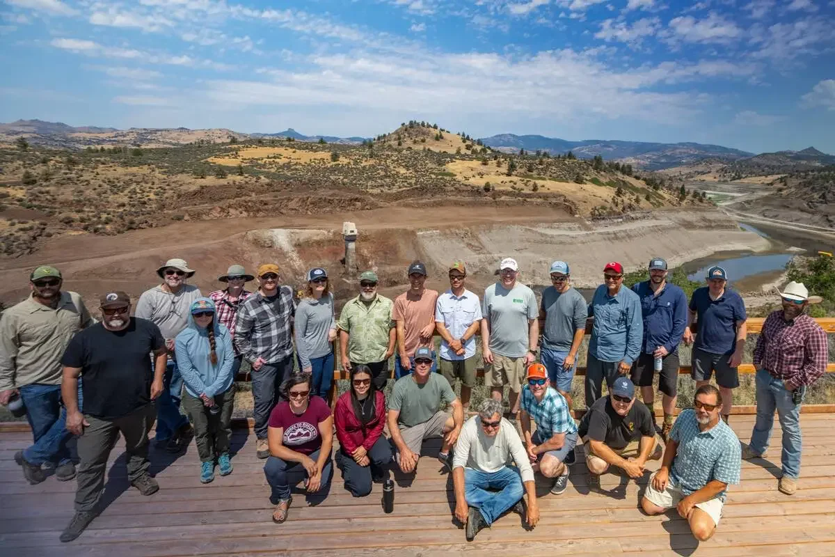
The monitoring project team at a kickoff meeting. (Image: CalTrout)
How Scientists Are Tracking Fish Movement
To monitor salmon migration across the newly reopened river system, the research team uses a multi-layered tracking approach, combining traditional fieldwork with advanced technology. Methods include:
Sonar fish counting stations enhanced with artificial intelligence
Passive Integrated Transponder (PIT) tagging
Radio telemetry
Tangle net capture and release sampling
Spawner surveys and genetic analysis
Together, these tools allow scientists to track where fish travel, when they arrive, and how they use newly accessible habitat across hundreds of river miles.
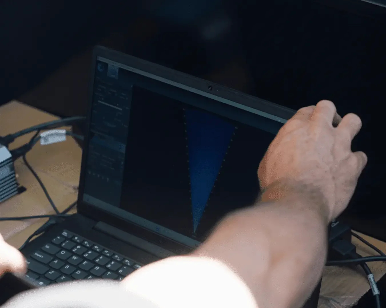
Sonar and AI at the Former Iron Gate Dam
In fall 2024, researchers installed a sonar fish counting station at the former Iron Gate Dam site—now the entrance to reopened upstream habitat. The system uses sound waves to generate continuous, video-like imagery of fish as they pass through the river channel.
Scientists analyze the sonar footage by examining fish size, movement timing, and swimming behavior to differentiate species. The station documented fish migrating upstream just days after dam removal construction was completed, providing some of the first evidence of rapid recolonization.
Artificial Intelligence Doubles Counting Efficiency
In 2025, CalTrout partnered with the Fisheye Project to integrate artificial intelligence into the sonar analysis process. The project operates under the broader Visipedia initiative, an academic consortium known for conservation tools such as iNaturalist and Merlin Bird ID.
Using advanced computer vision, the AI system analyzes sonar footage frame by frame, automatically detecting fish, tracking their movement, and determining whether they are swimming upstream or downstream. This allows scientists to calculate “net crossings,” preventing the same fish from being counted multiple times.
“For every frame, the model looks for fish and draws a box around each detection,” said Dr. Michael Hobley, a Caltech postdoctoral researcher and lead scientist on the project. “When a fish crosses the center line moving upstream, that’s a plus one. If it goes downstream, that’s a minus one.”
The AI system does not replace human review. Instead, biologists validate its outputs using existing software, with much of the manual counting already completed.
In 2024 testing, researchers reported:
98.4 percent accuracy near the riverbank
75 percent accuracy across the full river width
Up to twice the processing speed for human reviewers
Detection of fish that human counters may have missed
What Comes Next for AI Monitoring
Researchers are now working on several enhancements to the AI system, including:
Length estimation to better distinguish Chinook from other species
Real-time field deployment to alert crews as fish migrate
Calibration improvements tailored to Klamath-specific river conditions
Project leaders say the Klamath River deployment has become a flagship case study for how artificial intelligence can support fisheries science.
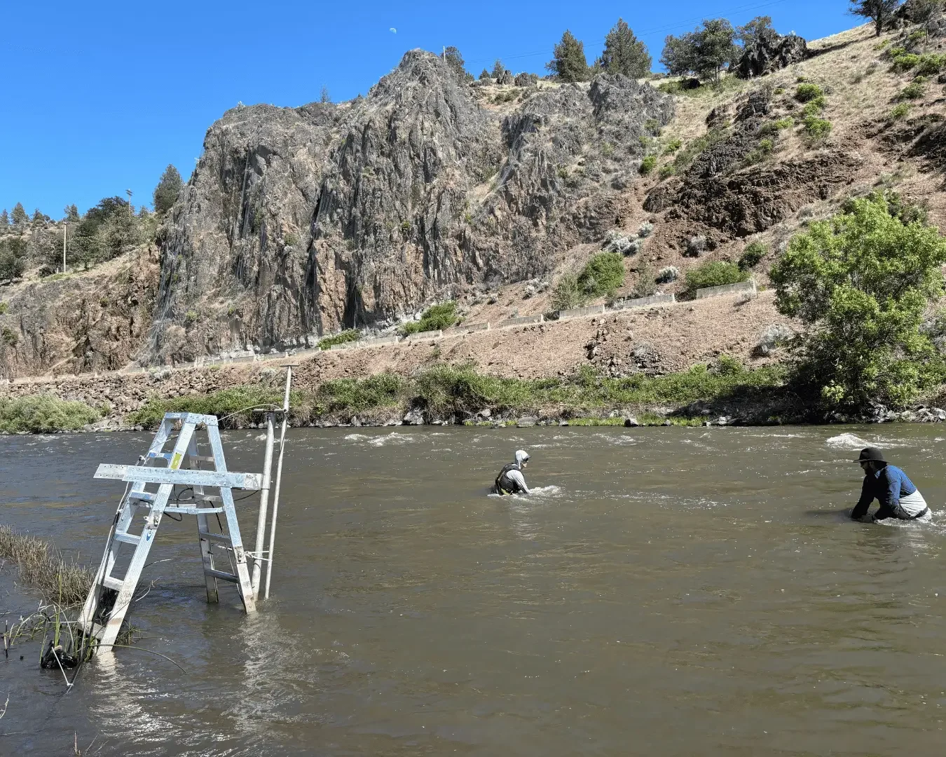
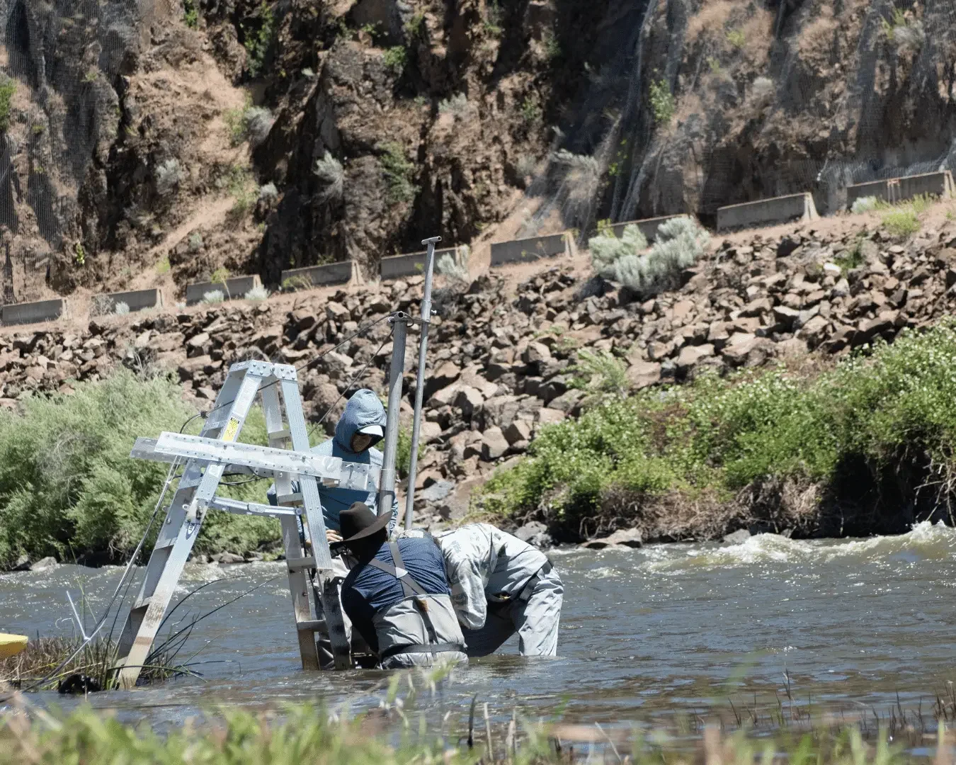
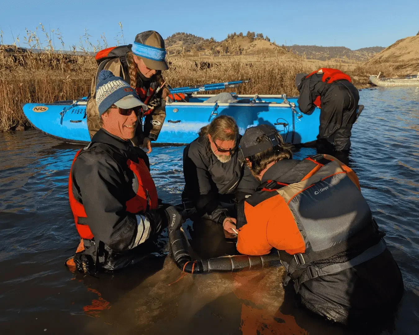
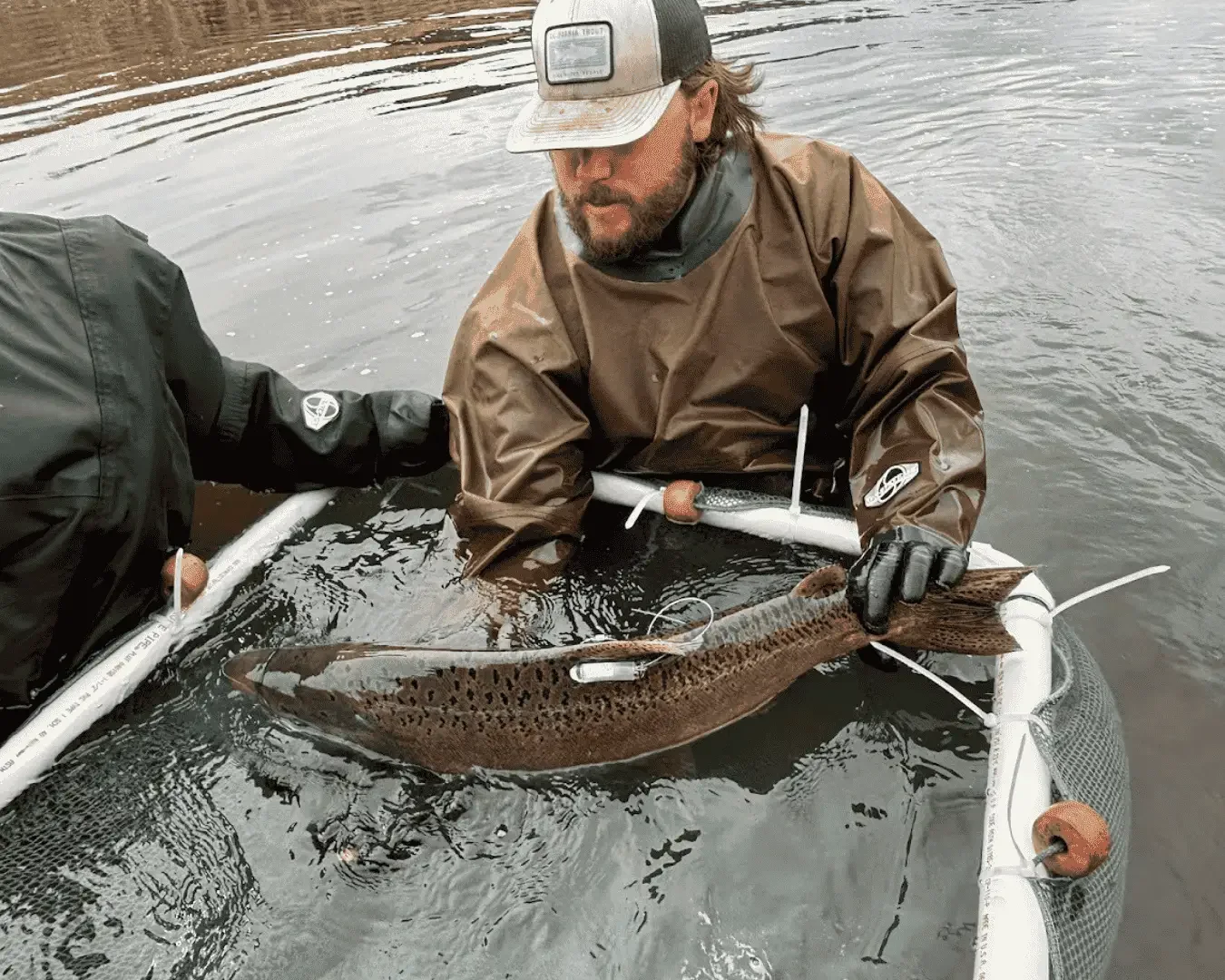
Hands-On Tagging and Genetic Sampling Upstream
Once fish pass the sonar station, monitoring shifts to direct field sampling. CalTrout, along with Tribal partners, uses tangle nets to safely capture adult salmon for tagging and genetic analysis.
Captured fish are fitted with PIT tags and radio transmitters, allowing scientists to track individual movements through former Copco and J.C. Boyle dam reaches, across the Oregon-California border, and into upstream tributaries.
A network of more than 15 stationary receivers, combined with mobile tracking and aerial surveys, allows researchers to follow fish throughout the watershed.
In 2025, sampling included:
Approximately 70 fish in California
Around 115 Chinook salmon across the full basin
Fewer than five fish identified as O. mykiss, with the remainder confirmed as Chinook
Researchers say the dominance of Chinook salmon in early sampling was unexpected.
Long-Term Monitoring Still Needed
While the first year of post-dam removal monitoring has exceeded expectations, scientists caution that full recovery will take years of sustained data collection. Planned future work includes year-round sonar monitoring, expanded genetic analysis, juvenile fish surveys beginning in 2026, and habitat assessments informed by new fish distribution data.
The project involves a wide coalition of Tribal governments, state and federal agencies, universities, and conservation organizations across Oregon and California. Researchers say continued monitoring will depend on stable funding, particularly as federal support remains uncertain.
For now, scientists agree on one conclusion: the Klamath River is responding faster than anticipated.
Cover photo: CalTrout | Original Article